TopMeteo: Weather for VFR pilots
Always well prepared
Aircraft weather
All important maps and forecasts in one software – mobile phone, PC and as an app. Don’t miss any more beautiful days and always fly safely and relaxed – with TopMeteo.

Always know when it's good flying weather
Never miss good flying weather again. With the 6-day forecast, you can already weigh up the weather for the weekend on Monday.
Spot good general weather conditions at an early stage. Plan relaxed flights, whether for business or pleasure!
More accurate forecasts directly on the day of the flight
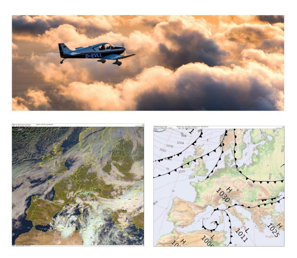
Significant weather
Quick overview of critical weather parameters
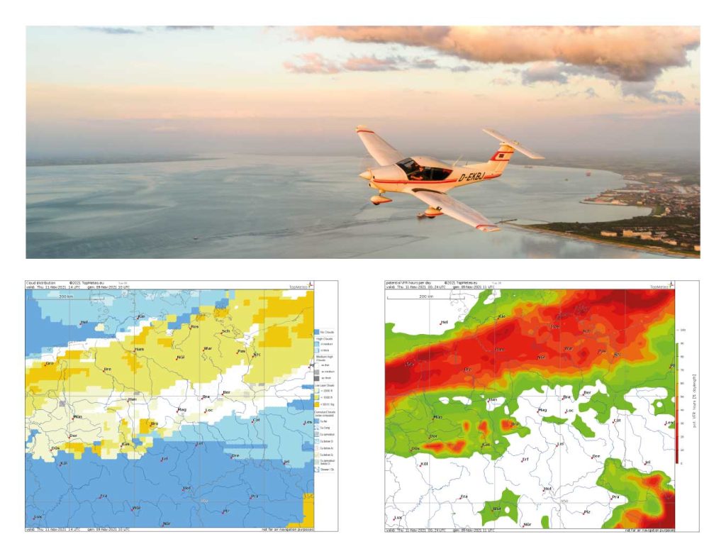
Cloud distribution
Know more precisely which clouds await you on your flight.
Potential VFR flight hours
Assess the whole day at a glance. For a quick overview of the whole week.


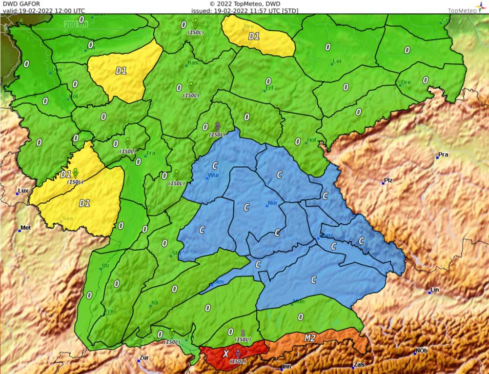
GAFOR
The popular forecast for Germany
Well-known GAFOR areas in DE and soon also in AT and CH
Additional weather icons
For easy analysis of the constraints
External data source
Directly from the German Weather Service (DWD)
In the cockpit - live images
iOS & Android app
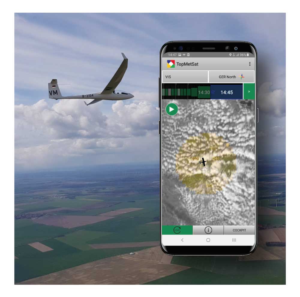
TopMetSat - the TopMeteo satellite app
Innovative image transmission
A modern transfer mechanism reliably takes care of fresh images in the cockpit. Unique on the market!
Locate thunderstorms unerringly
Avoid showers and thunderstorms safely and relaxed.

Frequently asked questions and answers
All our packages can be used for all air sports. They vary in scope but all provide access to all of our forecasts, images and actuals.
The decision is whether the whole world or just one country is needed. Which of course determines the price. Or whether a 2-hour or 1-hour forecast resolution is sufficient.
Yes, we offer a 7-day trial period with no obligation whatsoever.
Yes, in our TopMetSat app we offer a map that combines actual data with satellite images and thus makes it easier to decide whetheron top or not.
This question is easy to answer. We offer all the forecast products you need for a safe and legally compliant weather briefing.
Our partners


