Whether gliding, powered flight, hang-gliding and paragliding or ballooning -

Flight weather for better flights and rides

Thermal Maps, Potential Flight Distance Forecasts, Live Weather App, Flight Planning

Gliding forecasts

GAFOR Areas, Detailed Area Forecasts, METARs, TAFs, In-Flight App, Flight Planning

VFR forecasts

Local area forecasts, 10m wind (1kt resolution), Optimal thermal forecasts

Hang Gliding & Paragliding Forecasts

High altitude winds up to 7000m MSL, surface wind and gust forecasts, live radar app

Balloon forecasts

Our highlights

Professional forecasting models and real-time data
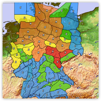
Daily forecast maps

For XC and VFR planning.

Assess the whole day at a glance.

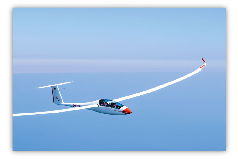
Just take a look at our video tips for a quick first impression.
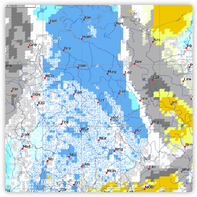
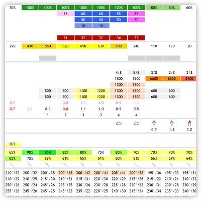
Hourly charts

For example, our cloud distribution. Our most popular chart among pilots.

The cloud image in a representation never before seen.
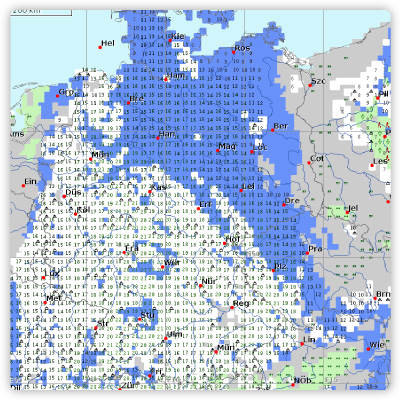
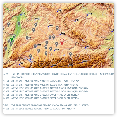
Detailed maps

Significant weather, cloud bases, blue or cloud thermals, and cloud spread trend.

All meteorological details needed before takeoff.

Our tools

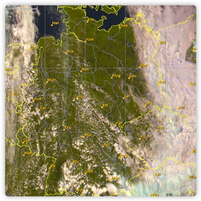
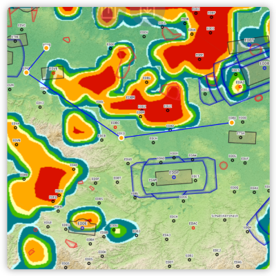
Satellite / Radar / Lightning

Special satellite imagery for flight operations. High resolution and every five minutes. Real-time cloud analysis (tops, ceiling, lightning, radar, ..)

Location forecasts

Save your own locations and create and share your take-off points via coordinates. The weather in one place for the whole day in a tabular overview.

Video tips

METAR / TAF

Current airport report along the route.

Flight planning

Route planning based on the forecast and with current airspace data. For VFR flights or in FAI mode for cross-country flights.

Video tips

DWD GAFOR

The popular representation of the GAFOR areas with data from the German Weather Service (DWD).

In-Flight Weather (iOS + Android)

The TopMetSat app – use current satellite and radar images directly in the cockpit.

7 days free trial

Try TopMeteo now

Completely non-binding - ends automatically